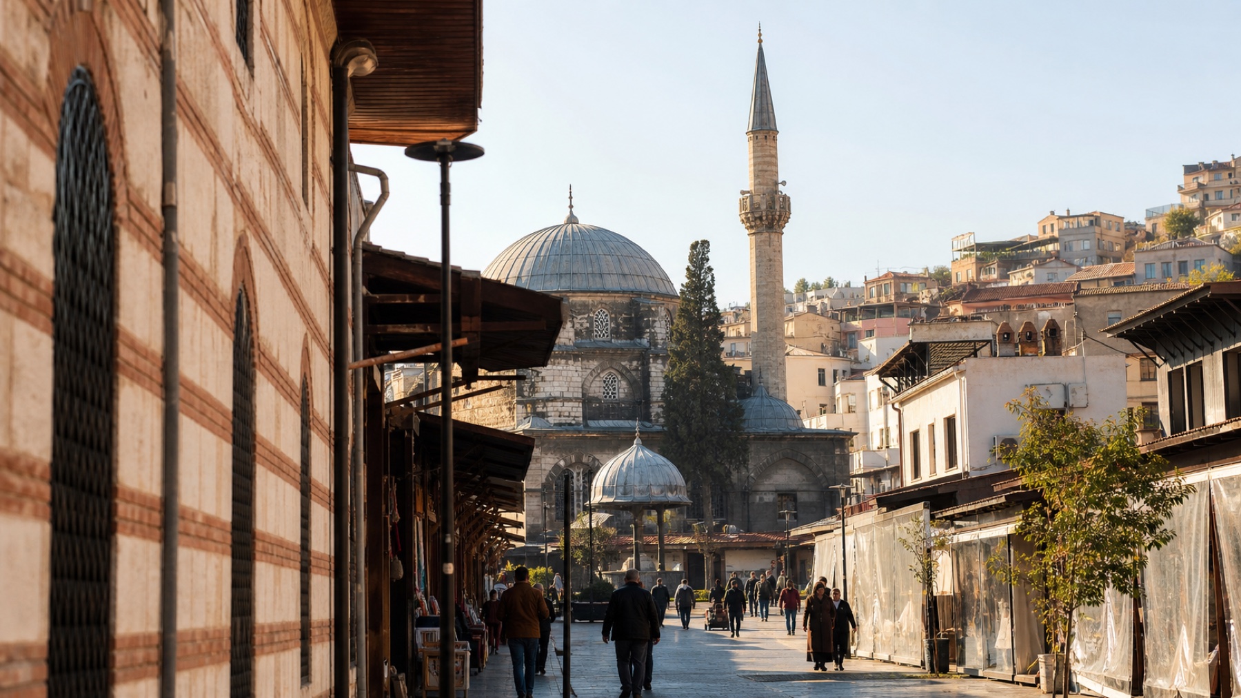
Central İzmir makes more sense when you imagine the water reaching farther inland. Kemeraltı’s curved commercial streets developed around an inner harbour that was gradually filled, while trade continued to shape the city between the waterfront and the slopes of Kadifekale. The result is not a museum quarter but a living urban landscape where workshops, mosques, synagogues, inns, cafés and archaeological remains still occupy the same compact geography.
What UNESCO Tentative List status means
The Historical Port City of İzmir was added to Türkiye’s UNESCO Tentative List in 2020. It is not yet a World Heritage Site. The nominated area brings together Kemeraltı, Basmane and Kadifekale and focuses particularly on how a port with ancient roots became a cosmopolitan commercial centre between the sixteenth and nineteenth centuries.
İzmir connected caravan routes from the Asian interior with Mediterranean shipping networks. Muslim, Christian and Jewish communities, merchants from different parts of Europe and the Ottoman world, craftspeople and travellers all contributed to its streets and buildings. The value of the district lies in that accumulated exchange rather than in a single monumental style.
A route through the old port city
Begin around Konak Square, where the Clock Tower and Yalı Mosque introduce the civic waterfront. From here, enter Kemeraltı slowly. The bazaar is not one straight shopping street; it is a network of lanes, courtyards, passages and historic hans. Kızlarağası Han is an accessible introduction, but smaller corners often reveal more of the district’s working character.
Continue towards Havra Street and the surrounding synagogue quarter. Several synagogues survive in close proximity, reflecting the long history of İzmir’s Sephardic Jewish community. Access varies and active places of worship deserve considerate behaviour, so organised heritage visits can be useful.
The Agora of Smyrna adds the Roman city to the route. Its colonnades and basement structures are striking, but the graffiti are especially valuable: thousands of written and visual marks preserve fragments of ordinary urban life. Higher on the slope, Kadifekale occupies ancient Mount Pagos and gives a clearer sense of how the Hellenistic and Roman city was positioned between hill and harbour.
How to visit well
Set aside most of a day rather than treating Kemeraltı as a quick shopping stop. The district is busiest during working hours and quieter on Sundays, when many traditional businesses close. Dress for walking, keep valuables sensibly secured in crowded lanes and ask before photographing people at work.
Eat along the way. A cup of Turkish coffee in a han courtyard, a plate of local food near the market or a stop for sweets is not an interruption to the heritage experience; commerce and hospitality are the reason this part of İzmir has remained alive.
Why a guided walk can help
The area’s layers are physically close but not always self-explanatory. A knowledgeable local guide can connect the vanished harbour, surviving religious buildings, Ottoman commercial system and Roman archaeology without reducing the neighbourhood to a list of photo stops. Whether you explore independently or with a guide, the essential rule is the same: leave time to wander and notice the city still being made around you.
Editorial sources: Primary source · Supporting source. Visitor information can change; verify opening arrangements before travelling.
Share a useful local note